Before I explain the heading designed to catch your attention let's go back a bit in the day.
This morning I had trouble with my GPS. I put in what looked like a town on the map called Litli Geysir. The GPS would not register. I tried another little "town" close by called Strokkur. Again no joy from the GPS. Both towns were in the geyser area where we wanted to go. So I resorted to navigating the old fashioned way by map. We got there. Having got there I realised why my GPS failed to register. Here is the first "town"
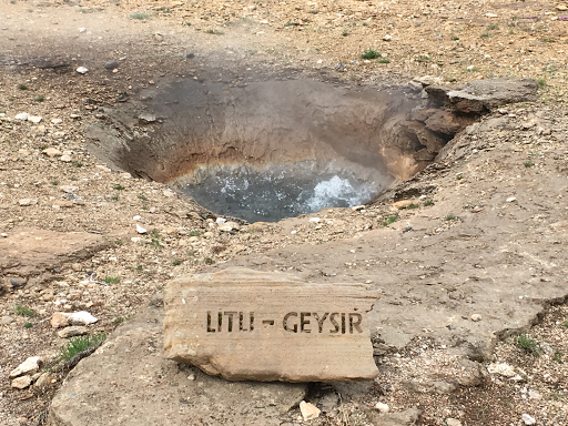
Followed by the second "town"
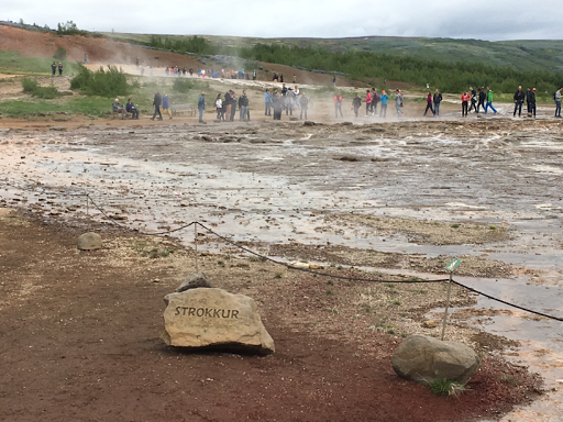
In other words both "towns" were actually holes in the ground called actually geysers. No wonder the GPS failed to register
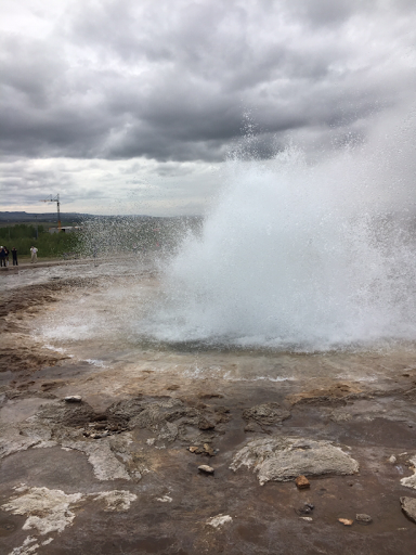
Once that was sorted out we watched the geysers in action. The signs were at pains to point out that thus geyser blew significantly higher than a geyser called "Pohutu" in a place called New Zealand.
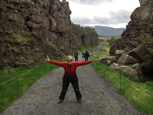
Then it was off to Pingvallir where we found that ,yes, we were both at fault !
Let me explain. Pingvallir is right on the mid Atlantic fault line that runs right up the middle of the Atlantic Ocean and thus separates North America from Europe/Africa. The actual fault line runs right thr Pingvellir which is about 50 km from Reyjkjvik. At this point if is about 2 km wide but within the fault are actual stress lines. Because the two continents are moving apart at about 2 cm per year every so often these cracks or stress lines widen. So here is the actual geological boundary between the Old World and the New World. Diana is pushing both worlds apart.
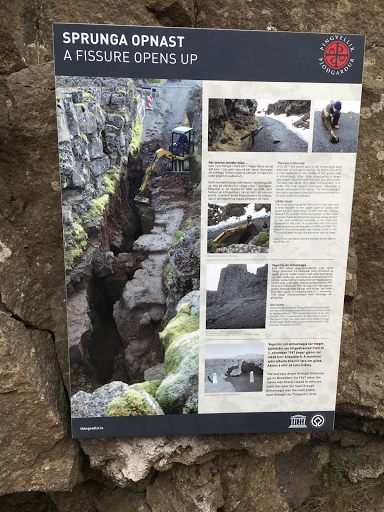
And here is a crack that opened just several years ago-
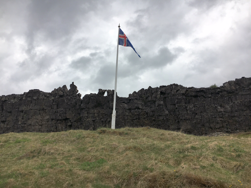
Right on the actual fault line was the site of the first Icelandic parliament( even tho they did not know it was a fault line in 1000AD !) and the site of the Icelandic declaration of Independance in 1944
So thus having decided we had collectively been "both at fault" we felt that we should not "leave a rift between us" and on that happy and punny note we rode west to the capital of Reyjkjvik for a two day stopover.
Comments